In July 2014, we hiked north fork trail and camped at Sam Mack Meadow, a beautiful hidden valley carpeted by thin grass. With a short ascending from valley floor to the ridge, one can enjoy the spectacular view of three glacier lakes.
Both sunrise and sunset are good. A few nice photo spots are at GPS locations: N37 07 11.4 W118 30 10.0 - this was where my sunrise photos were taken, N37 07 04.0 W118 30 11.7, N37 07 01.9 W118 30 12.5 and N37 06 56.6 W118 30 12.2 - this was where my sunset photos were taken.
The last section of the trail to view Palisade Glacier is not easy. There is no designated path. You will have to hop on big rocks till the end (GPS location: N37 06 23.8 W118 30 12.0). Although I did not wait for sunset in this area, by observation sunset is supposed to be good. The setting sun will light up the peaks above the Palisade Glacier. If you are hardcore enough, you can probably camp in this area to wait for sunset or summit Mount Sil, one of the 14ers in California.
We also day-hiked the south fork trail. It was a strenuous 11 miles hike to both Willow Lake and Brainard Lake. The view however did not impress me. The best view was at the pass in the middle of the trail. If you can only do one hike, I would suggest the north fork trail.
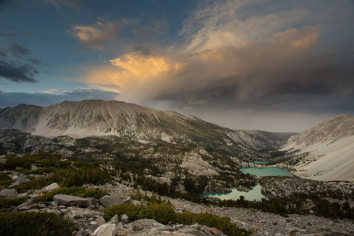
Sunset view from the trail to Palisade Glacier | Lakes from near to far are the third lake, the second lake and the first lake.
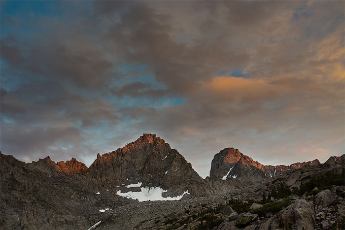
Sunset view from the trail to Palisade Glacier | Mount Gayley and Mount Sil
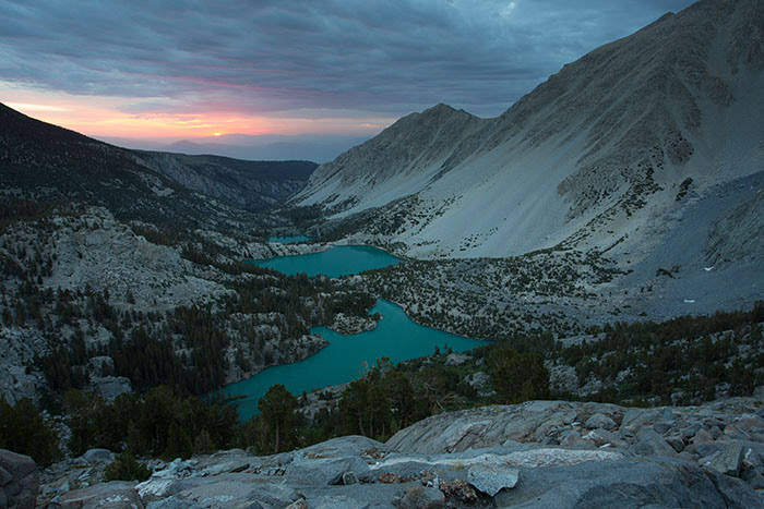
Sunrise view from the trail to Palisade Glacier
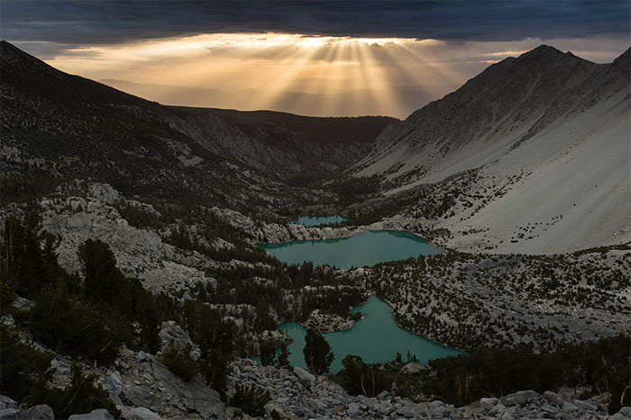
Sunrise view with light beams from the trail to Palisade Glacier

Early morning view on the trail to Palisade Glacier | A small pond.

Palisade Glacier