Reflection Canyon is located at Lake Powell, Utah in Glen Canyon Recreation area. The photo of this canyon was originally published on National Geographics magazine in 2006. Since then, more and more information about how to venture to this hidden gem is posted online. Here is my report after we finished the trip in Feb 2015.
Water level of Lake Powell is important. If the water is too high the curves of the canyon will submerge. Without those curves the canyon will look less impressive. Before your trip be sure to double check above link for the water level. For your reference, at the time I took these photos, the water level is at about 3593 feet. If the water level goes above 3600 feet, you should rethink if the trip is worth the effort.
My GPS track, Reflection Canyon.gpx, can be downloaded from GPS Tracks Collection.
To get to the trailhead, you will need to drive about two hours along the unpaved Hole-in-the-Rock road. At the time of Feb 2015, the road was in pretty good condition. We had no problem to get to the trailhead by my crossover SUV. The first section is in excellent condition, a regular sedan is passable. I would not recommend a sedan for the last a few miles. It might be passable but it would be tough. You should call Escalate visitor center before coming to this area. If it has rained recently or a rain is expected, the road might be impassable at all.
The hike is moderate. Although the strenuousness is nowhere near to get on top of Mt Whitney, the real challenge is there is no water to filter along the hike. You will have to take two days of water if you want to camp there to take sunrise and sunset photos. This is why I choose winter for the trip because of lower temperature water consumption is lower also. For your reference, we two took about 3 gallons of water, which was more than enough for us. The temperature was 32F low and 68F high.
This is a wilderness travel. There is no established trail although you might see a faint trail from time to time. The hike takes about 5 hours if you do not make many mistakes. You will need to have some basic navigation skills and know how to read topo map. For safty reason, you want to take a compass and a topo map as a backup. After you start the hike, most likely you will be on your own. For two days, we saw nobody.
I took a 17-40 lens and a 14mm F2.8 for night stars. I do not think a telephoto lens was necessary. Obviously a tripod was needed.
I like the sandy camping spot at N37° 11.260' W110° 55.252', which seems to be the closest location to the photo spot at N37° 11.223' W110° 55.150' and N37° 11.242' W110° 55.139'.
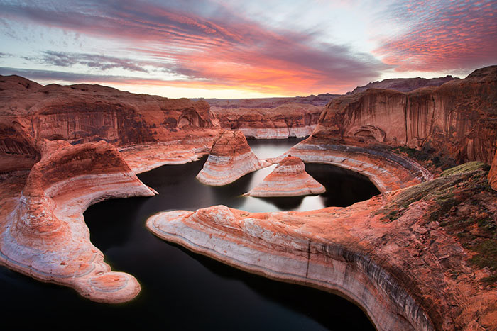
Sunrise at Reflection Canyon | This photo the grand prize winner of Share the Experience photo contest sponsored by U.S. Department of Interior. It was printed on 2017 National Park Annual Pass and were shared with half million park visitors.

Sunrise at Reflection Canyon with Sunburst
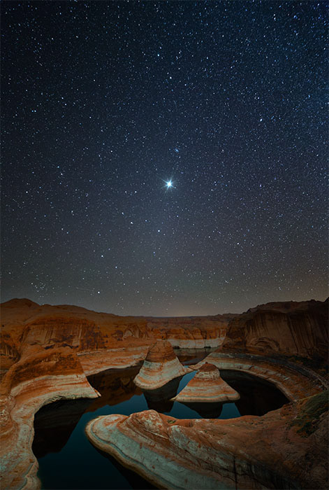
Night stars on top of Reflection Canyon
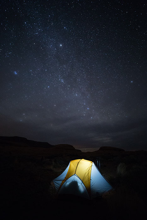
Stars over my tent
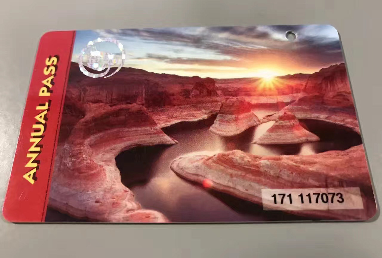
2017 National Park Annual Pass with my photo
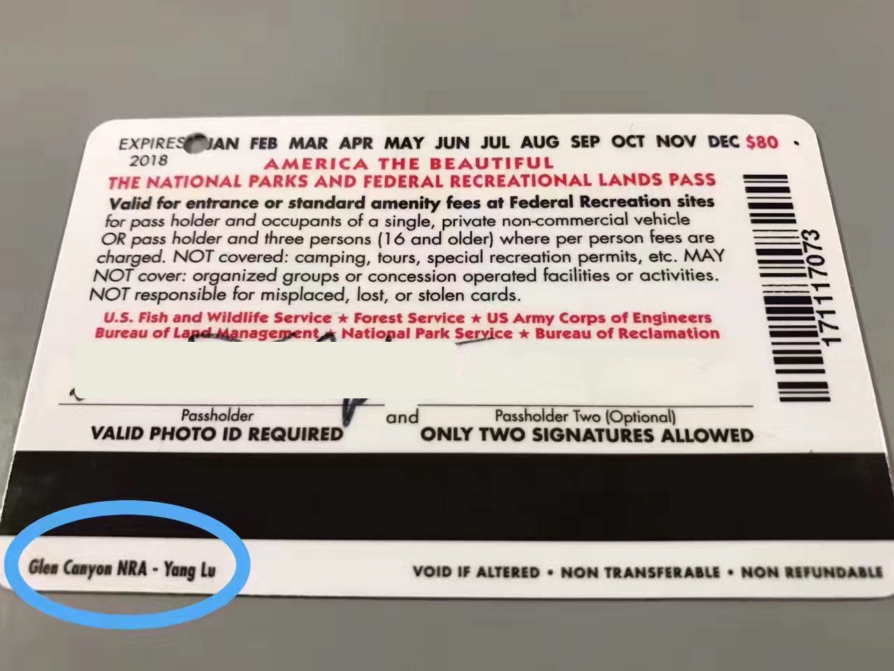
2017 National Park Annual Pass with my name