From September 3 to September 9, 2017, we finished a 7-day, 6-night backpacking trip in Titcomb area. It was a loop from west side of valley to cross Knapsack Col, then approached Titcomb Lakes. The trip was amazing. The scenery was absolutely beautiful and powerful. Titcomb basin brought my memory of French Valley of Torre del Paine, but prettier with all the lakes. This was my first time saw so many lakes in one trip. A small disappointment was there was a wild fire going on those days. Becasue the air was not clear, photos did not come out as I expected. But regardless, I absolutely enjoyed the trip. I am sure you will do too.
Here is my trip report. My GPS track, Titcomb Basin Loop Wind River Range.gpx, can be downloaded from
GPS Tracks Collection.
Day 1
We started from Elkhart Park trailhead. After about 7 miles, we camped at Sapphire Lake. It was solitude. At sunset, a small hike brought us to the hill at N43° 02.476' W109° 40.784'. The sunset was nice but nothing comparing to what we saw in later days.
Day 2
We camped at Lower Jean Lake. I think Lower Jean Lake offers better view than Upper Jean Lake.
Day 3
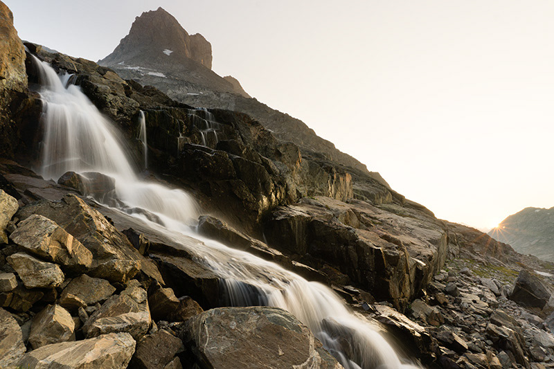
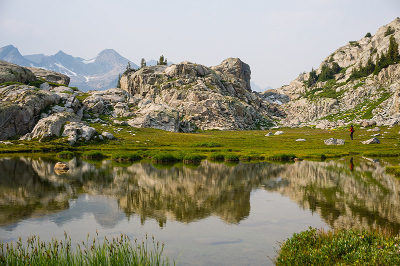
We continue to Peak Lake. Descending from Shannon Pass to Peak Lake was very interesting hike. On north side of Peak Lake, there was a small trail that led us to the valley. One mile after Peak Lake we reached to a cool waterfall. We camped in that area. Watching sunset at the waterfall was pretty good.
Day 4
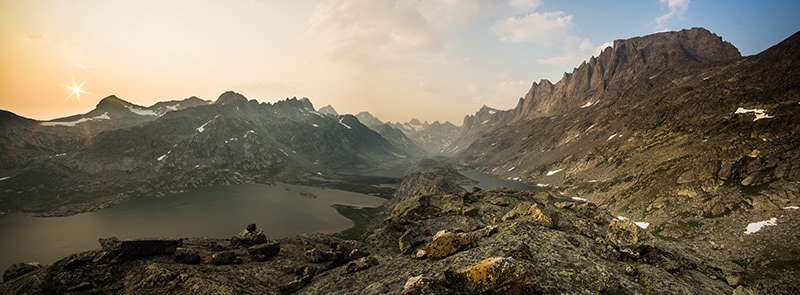
This was the most difficult day in the entire trip, as we were about to cross Knapsack Col to enter Titcomb basin. There was no clear trail in this section. We needed to ascend 1200 feet to get to the col, then down into the valley in rocky terrain with heavy backpack. Some sections, especially after crossing the col, were class 2 route. The view on the col was amazing. I have to say it was worth the effort even just for the view itself. You would be rewarded by two glaciers and numerous peaks.
Depending on the time of travel, crampon or microspikes might be required. The time we were there we did not need though. Plan this accordingly.
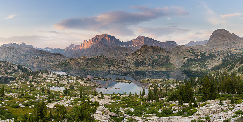
When we reached to Upper Titcomb Lakes, we felt it was so pretty and decided to camp there. Next day, when we got to Lower Titcomb Lakes, we realized it was even more beautiful there. If I did this trip again, I would go straight to Lower Titcomb Lakes and stay there for a few nights.
Day 5
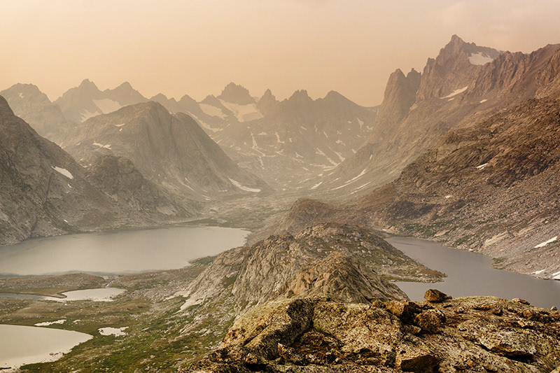
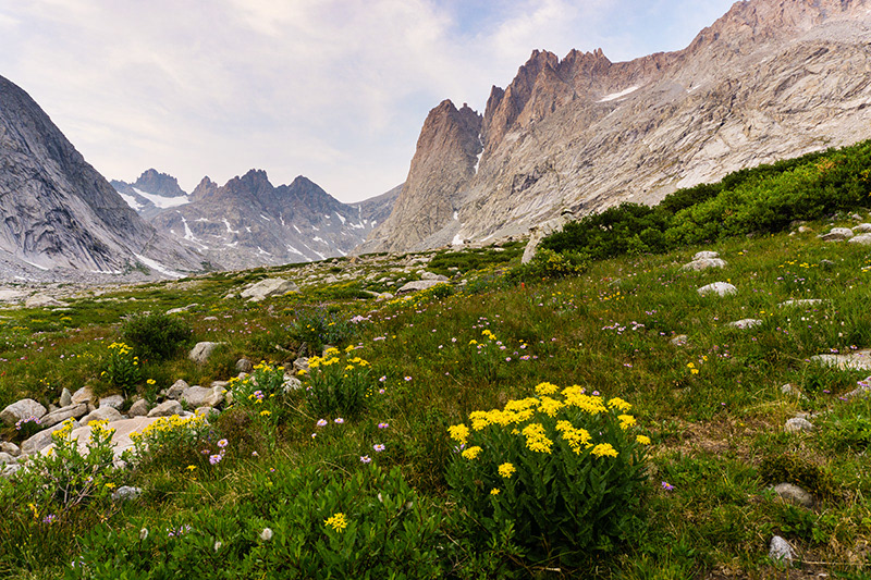
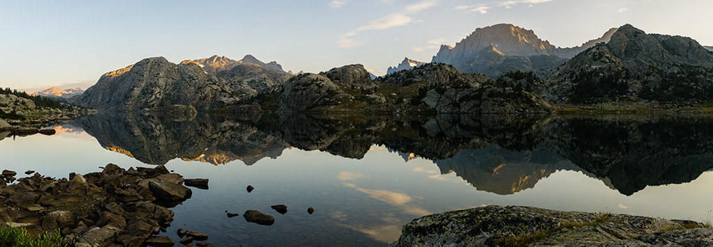
We hiked about two miles to move the camp to Lower Titcomb Lakes. There were some most beautiful sceneries I had ever seen. We explored surrounding areas and hike first sections of Indian basin. At two hours before sunset, we started to climb the hill nearby. The peak is at GPS location N43° 06.816' W109° 37.946' with 400 feet gain. On the top, you can see both Titcomb Lakes and Mistake Lake, which you won’t see if you did not climb. I consider this was one of the best sunset viewing platform in this area. All your effort will be completely rewarded. Try to get there a little early before sun goes down under the west side of the mountain.
Day 6
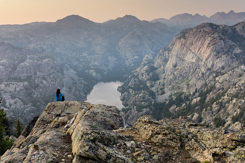
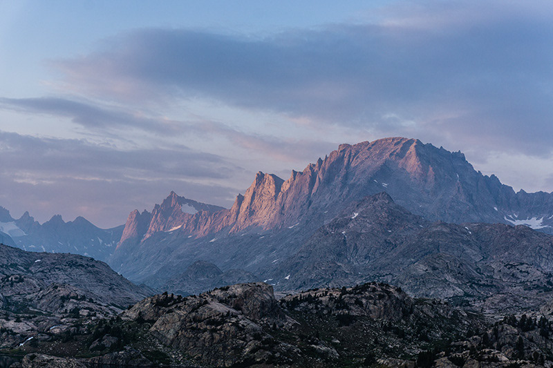
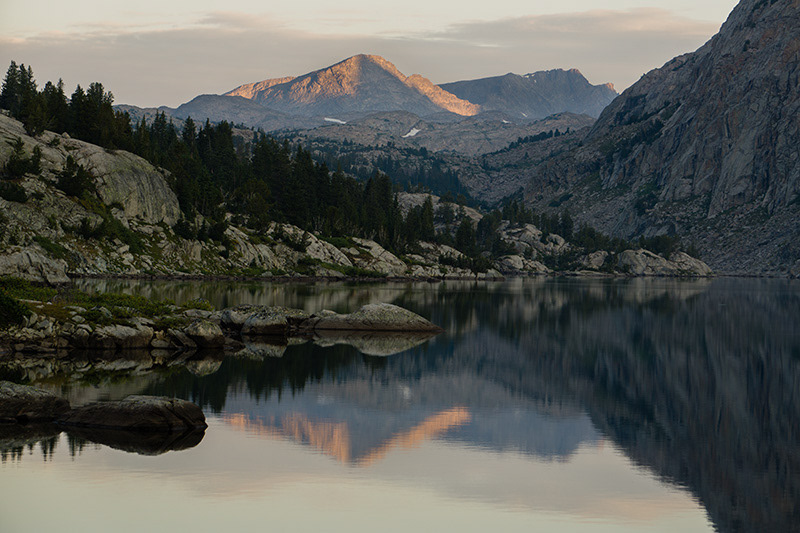
In the morning, we hiked to another small hill at GPS location N43° 06.509' W109° 38.414' to see sunrise. It offered nice view to see both Titcomb Lakes. Then we move our camp to Island Lake, another highlight in our trip. Watching sunset at Island Lake was an unforgettable experience. I feel better views were offered on top those surrounding hills. The one we went was at GPS location N43° 04.729' W109° 38.169'. It was an easy hike but with huge reward. It was breathtaking when the last sun beam hit the Fremont Peak.
Day 7
We watched sunrise at lake shore. Sunrise, because it came from back of mountains, were not as impressive as sunset. But it was still very nice. We got many reflection photos. After breakfast, we hiked about 12 miles back to Elkhart Park trailhead. The feeling of going back civilization was exciting.