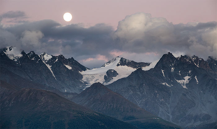
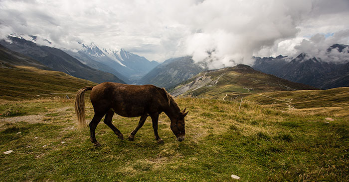
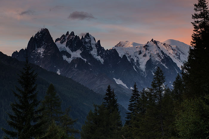
My wife and I completed Tour de Mont Blanc (TMB), one of the best hike in the world, between September 1 and September 10, 2014. The hike has some best alpine sceneries I have ever seen - numerous glaciers, mountain peaks, ranges, European villages, alpine meadows - you name it.
We primarily used the book "Cicerone Guide by Kev Reynolds, Tour of Mont Blanc" to prepare the trip. The book is very informative. Before we start the hike, we also bought two 1:25000 maps, 3630 OT and 3531 ET at Chamonix. The maps are beautifully made and in great details. A small drawback is that you will need two 1:25000 maps to cover the entire region, whereas if you use 1:50000 map, you will only need one. If I did it again, I would choose a 1:50000 map to reduce some weight as the entire trail was pretty much clearly marked. The maps was only used occasionally.
We also carried a handheld GPS. Similar as maps, it is useful when you suspect if you get lost. My GPS tracks of entire hike, Tour du Mont Blanc.gpx, can be downloaded from
GPS Tracks Collection. You will notice that indeed at some spots we got lost. Please note that the first 3.5 miles on day 10 was not correct trek and you should not follow it (see the descriptions of day 10 below for more details).
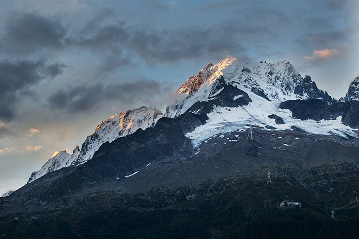
Photography plays a big part in my travels. In early September, sunset time is at about 8pm in Mont Blanc area. If we stayed in refuges, because their dinner time starts at 7pm, I might not have enough time to take sunset photos. Eventually we decided to carry a tent and full backpacking gears to give us more freedom. Another advantage of camping is that you do not have to sleep with strangers in the same room. Most of rooms in refuges are shared. In some refuges there are three levels of beds, just like dormitories in college. Beds can be placed side by side and there can be no gaps between two beds. There is a good chance a sleeper next to you is in opposite sex. Camping in our own tent indeed gave us better sleep. The drawback of camping, however, is obvious - the weight we had to carry was dramatically increased.
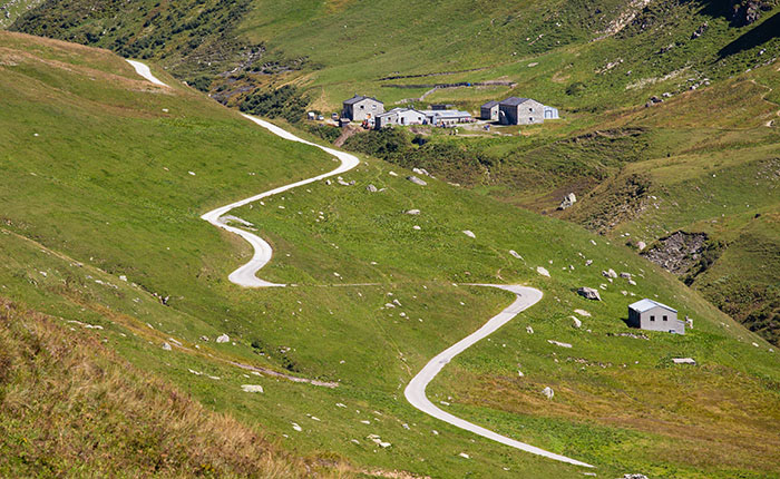
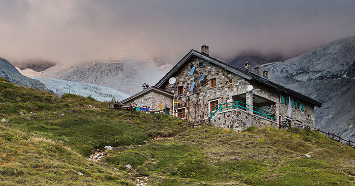
In this trip we camped for 4 nights, stayed in an Italian refuge, Rifugio Bonatti, for one night, stayed in hotels for rest of nights. Rifugio Bonatti, which presumably is the best refuge along the hike, is worth mentioning. We stayed in a room shared with 7 people. The refuge was clean. Staff were friendly. 3-course dinner was delicious. In such a remote area, where helicopter is used to transport food and trash, the refuge exceeded my expectations.
I took the following photo gears: Canon 6D camera with a RRS L-plate, Gitzo 1541T tripod with center column removed, RRS BH-25 ballhead, Canon 17-40 F4 lens, Canon 70-200 F4 lens, remote shutter release, a regular polarizer and a gold-n-blue polarizer. This setup worked well in relatively low weight. Those two polarizers were not used much. If I did it again, I would leave the gold-n-blue polarizer home. I also believe a 24-105 lens is more useful in this trip than the 17-40, which I took. But this is a trade-off of weight as 24-105 is 6 ounces more than 17-40.
Here is the list of major backpacking gears we took. Note that rain gear is important. It is normal to hike and pitch tent in a rain.
Tent: Big Agnes Copper Spur UL2
Backpack: HMG Windsider 3400, Ospery Ariel 65
Sleeping bag: Katabatic Palisade, Wester Mountaineering Ultralite
Sleeping pad: Therm-a-rest NeoAir XTherm, XLite
Rain Jacket, Poncho, Sleeping bag liner (used in refuge), Down Jacket, etc.
With additional weight of backpacking and photo gears, we also shortened the time from typical 11 days to 10 days and used two more difficult alternative routes. While enjoying the trip very much, we knew we pushed the hike to be a lot more strenuous than most hikers did.
Day 0 - Chamonix
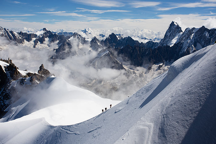
We stayed in a hotel in Les Houches and did a day trip to Chamonix to buy supplies. The train from Les Houches to Chamonix was free if you stay in a hotel in Les Houches, and convenient. Chamonix is an outdoor town. You can get pretty much everything you need from there. We got maps, propane canister and food. We also took the tram to the top of Aiguille du Midi. The view on top was breathtaking. I highly recommend this side trip. As a bonus, we also saw the finish line of Ultra-Trail du Mont-Blanc (UTMB). It was impressive that those athletes continuously running for a day to complete the 166km mountain trail!
Day 1 - Les Houches to Les Contamines
We took the alternative route that splits from Col de Voza to east. This was a very strenous hike, especially for the first day, when we not only carried a few days worth of food but also suffered jet lag. The alternative route required to hike over two passes. The downhill from Col de Trient was very steep and rocky. At the end of the day, we were really tired. My GPS showed we hiked 13.7 miles with 6055 feet elevation gain and 5590 feet loss! Comparing the scenary with later days, I think the alternative route is not worth the additional effort. If I did it again, I would take the normal route, which would be a lot easier as there is only one pass needs to be climbed over.
Day 2 - Les Contamines to Refuge Col du Bonhomme
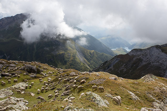
11.6 miles, 6665 feet elevation gain and 2343 feet loss. It was uphill most of time. The view became nicer and nicer as we hiked up. We met about 5 campers at Refuge Col du Bonhomme. The view at campsite was nice but it was too foggy to see a sunset at that time.
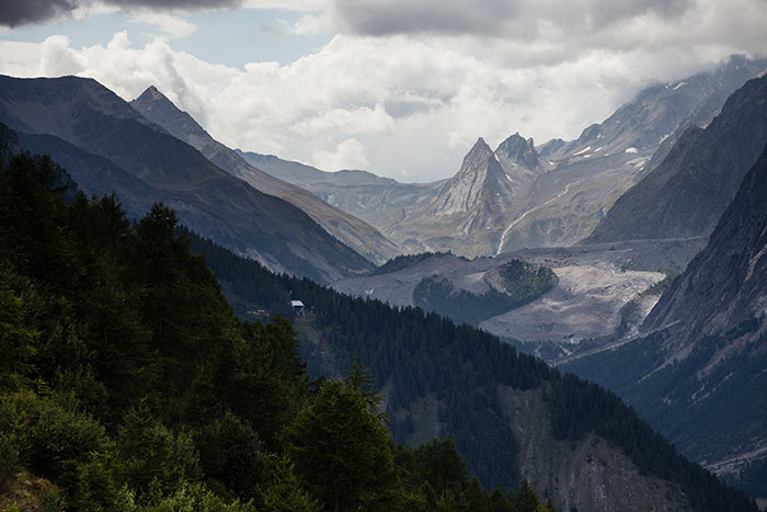
Day 3 - Refuge Col du Bonhomme to Refuge Elisabetta
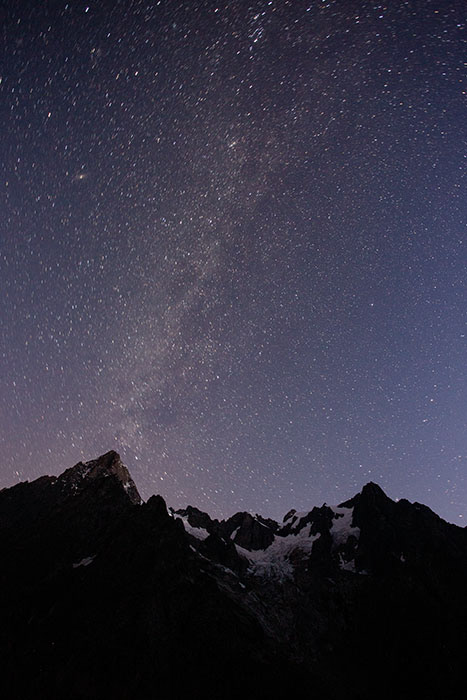
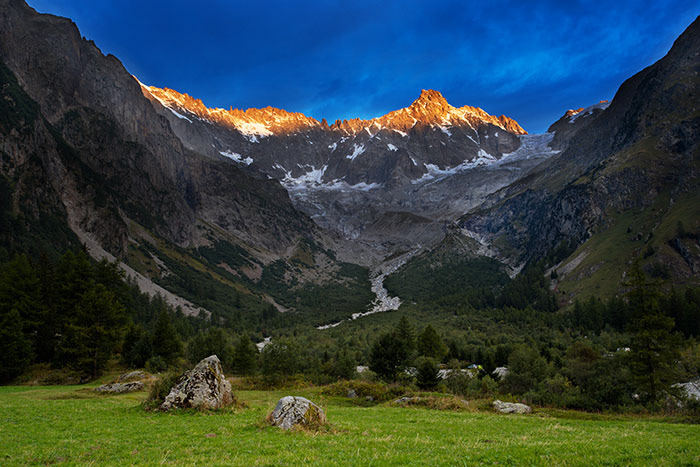
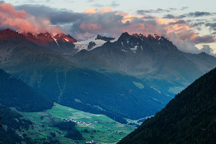
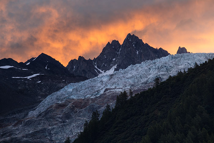
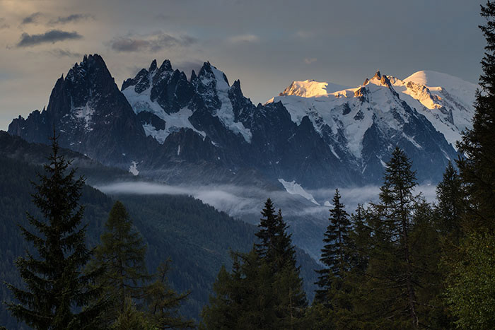
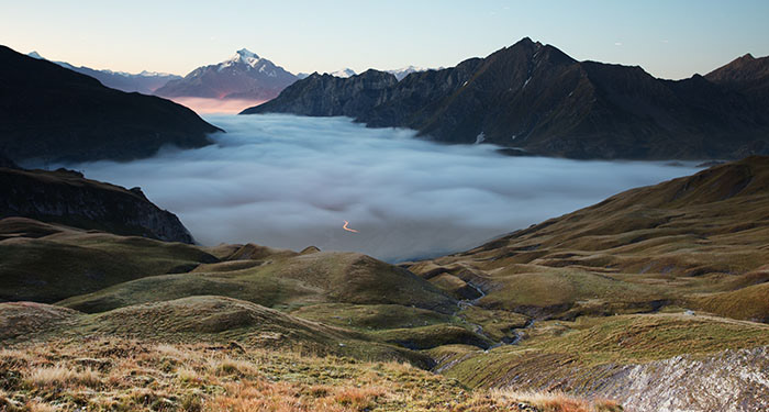
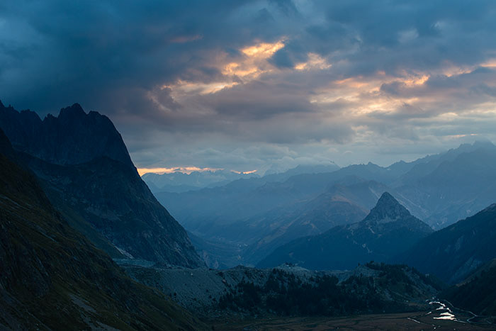
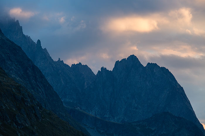
Again we took the alternative route from Col des Fours going east directly to Glaciers. The distance was supposed to be shorter than normal route. The downhill between Col des Fours and Glaciers, however, was quite steep and rocky. The view was nice, but I do not think it was extraordinary. If I did it again, I probably wanted to use the normal route via Les Chanieux. My GPS showed 10.6 miles with 3936 feet elevation gain and 4912 feet loss. Although the number looks moderate, it was actually not an easy day because of the difficulty between Col des Fours and Glaciers. The view at Refuge Elisabetta was gorgeous. Sunset was amazing. There were at least ten tents in front of the refuge that night!
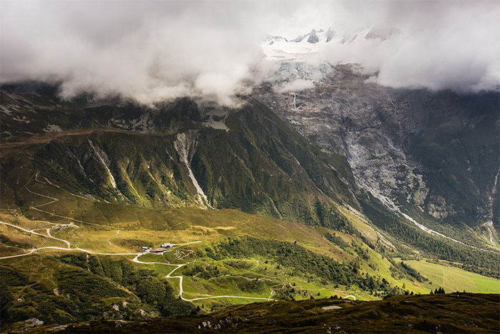
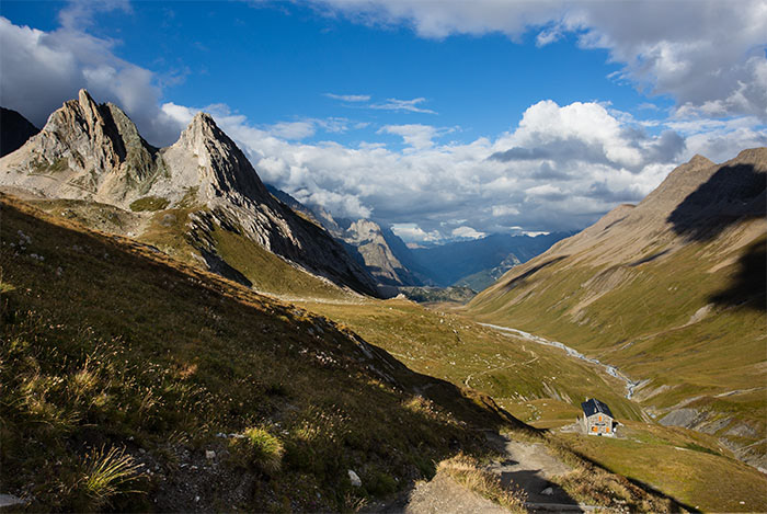
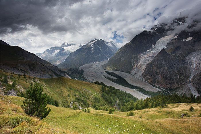
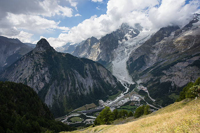
Day 4 - Refuge Elisabetta to Courmayeur
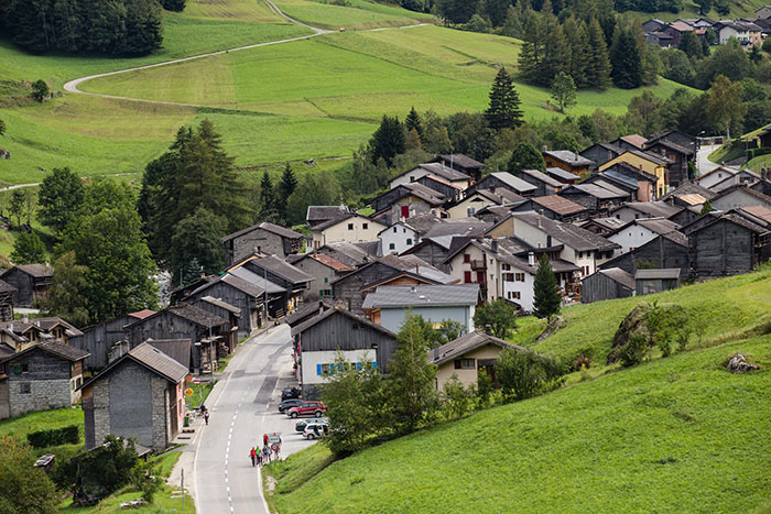
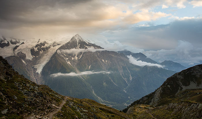
The best view started from here and lasted till the end of trip! The small town Dolonne deserves some exploring. The downhill between Refuge Maison Vieille and Dolonne was very steep and strenuous. Do not underestimate the difficulty. We hiked 12.9 miles with 2810 feet elevation gain and 5898 feet loss.
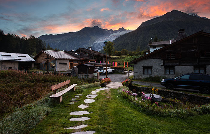
Day 5 - Courmayeur to Refuge Bonatti
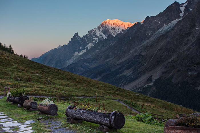
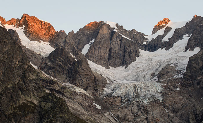
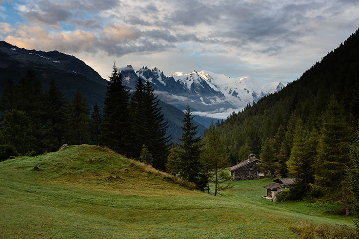
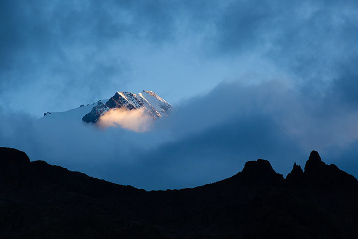
This was a moderate 9.05 miles hike with 4932 feet elevation gain and 2291 feet loss. We stayed in Refuge Bonatti. The refuge was very nice. 3-course dinner was delicious. Although the breakfast was a bit simple, I had nothing to complain as it was in such a remote place. Sunrise at the refuge was stunning. You will see the first sun beam hit the top of Mont Blanc. Do not miss it.
Day 6 - Refuge Bonatti to La Fouly
15.1 miles, 4818 feet elevation gain and 6253 feet loss. The town of La Fouly deserves some time to explore. The campground in La Fouly is the best of the best! If you camp, this is definately a place you want to be as you literally camp at the foot of a glacier! Sunrise was amazing! Do not miss it.
Day 7 - La Fouly to Champex
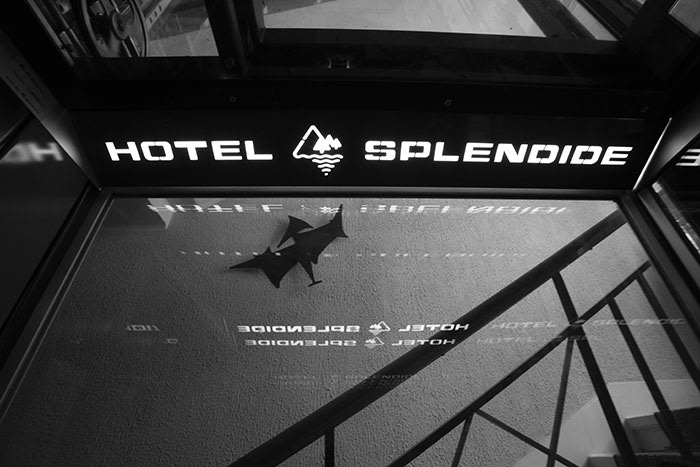
11.9 miles, 3645 feet elevation gain and 4064 feet loss. We stayed in Hotel Splendide in Champex. The hotel is on a hill facing to mountains. It has very nice view for sunset.
Day 8 - Champex to Le Peuty
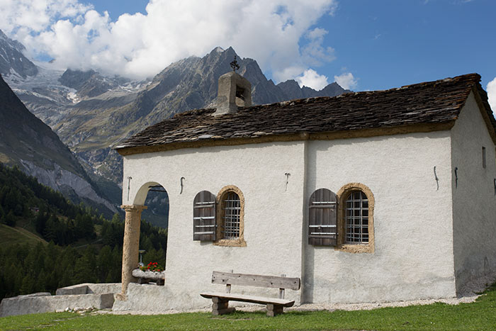
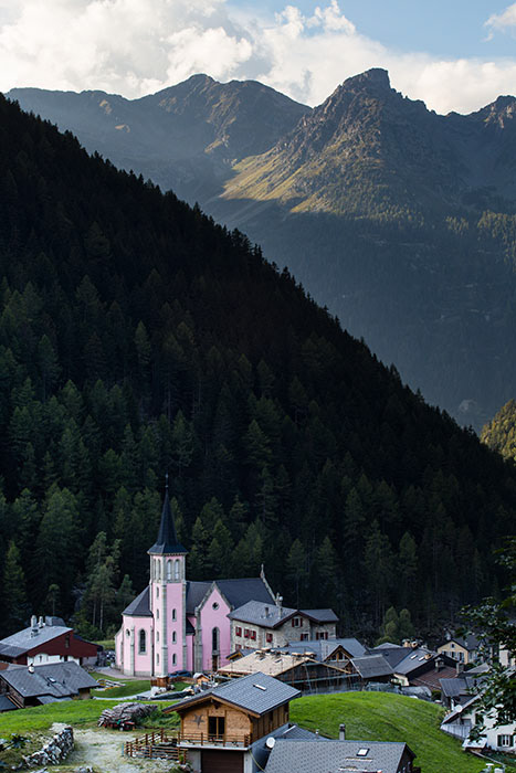
12.3 miles, 5041 feet elevation gain and 5477 feet loss. The town of Trient has a very nice church in pink color. It deserves some time to explore. If you camp like us, please be aware that there are some sources mentioned there was a campground in Trient, but we did not find it. The only campground we found is in Le Peuty.
Day 9 - Le Peuty to Tre Le Champ
9.34 miles, 4431 feet elevation gain and 4215 feet loss. Our original plan was to camp at Lac Blanc. After hiking in rain for a few hours, we eventually decided to change our plan to stay in Tre Le Champ. We camped at a campground managed by a refuge called Boerne. After enjoyed a 3-course dinner and hot shower in the refuge, we had a comfortable sleep. Sunrise in next morning was amazing.
Day 10 - Tre Le Champ to Les Houches
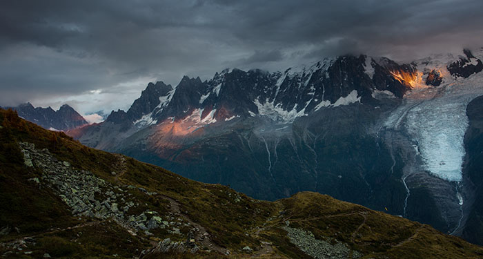
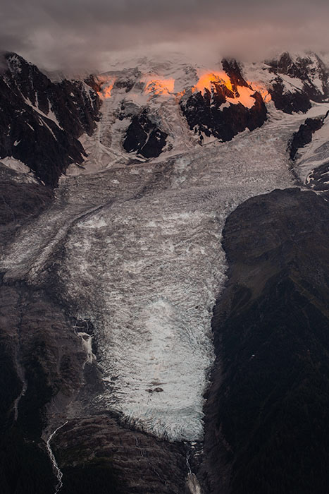
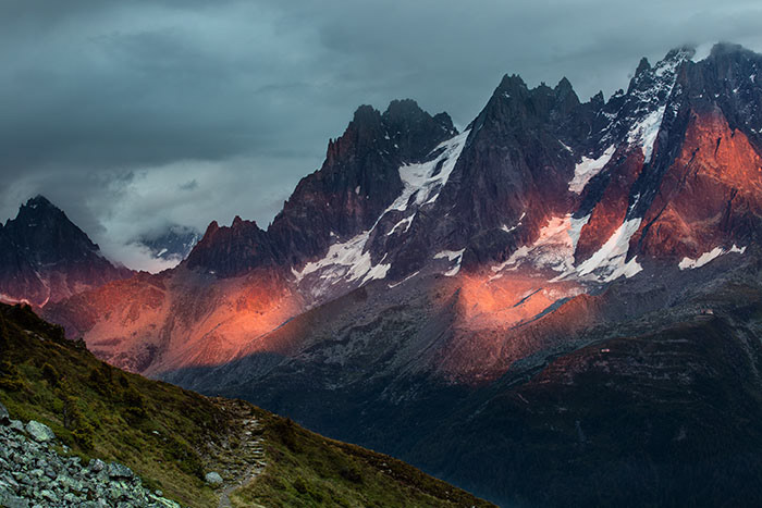
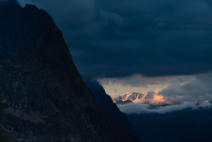
This was our last day on the trek. With distance of 16.2 miles, 6767 feet elevation gain and 8082 feet elevation loss, it was also the most grueling hike we did in the trip. But we were totally rewarded by the stunning views and felt it was worth every effort. Especially, at the area near Refuge de Bel Lachat we experienced an unforgetable sunset after a storm. The trade-off was we had to hike 3 hours in complete darkness to our hotel in Les Houches.
If you download my GPS tracks, please be aware that at the beginning of Day 10, for the first about 3.5 miles we actually hiked on a wrong trek that was not part of TMB. Although it eventually merged to TMB, we missed the famous ladders. The correct trail starts at the north side of Tre Le Champ.